
MOLINE, Ill. — Parts of the Atlantic Ocean are unusually warmer than normal for this time of year with widespread sea surface water temperatures well into the 90s in spots, including Miami which has seen its water temperatures soar into the middle 90s! With all of this heat and energy sitting around, you'd think hurricane season would be off to a busy start. However, it takes much more than just a bunch of warm water. Things get quite complicated when you dive into the tropics. Speaking of which, let's do just that!
Still too early to draw conclusions
So far we've seen three named tropical systems in the Pacific Ocean and four named systems in the Atlantic Ocean. While that may not seem like a lot, the climatology of tropical systems in the Atlantic tells us we usually don't reach our fourth named storm until August 15. So, in that respect, we are ahead of schedule by about a month. The Pacific season is right on target as three named systems are typically seen by July 6.
In the next few months, several variables are going to be at play. Warmer water is just one of them. We know that warmer water equals more energy for storms to feed on, and possibly grow to be quite intense! However, as we have already seen so far this season, storm systems in the Atlantic have had a hard time getting organized.
Saharah dust and wind shear act to suppress development...so far
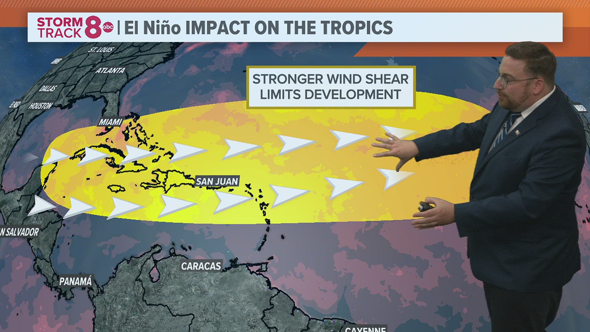
Now that we're officially in an El Niño pattern, the wind pattern surrounding the Gulf of Mexico and the Atlantic Ocean becomes an even bigger factor in determining how strong storms will get. Tropical systems, unlike severe thunderstorms here on land, hate wind shear. It tears them apart and prevents further organization and strengthening. In an El Niño pattern, wind shear is increased across the Gulf and Atlantic due to differences in temperature.


There is also a very large plume of Saharan dust migrating its way westward from Africa. This also acts to help suppress development. Most scientists agree that not only does the cloud of dust contain a low of dry air, but it also increases wind shear. Not a good combination for brewing up a tropical system.
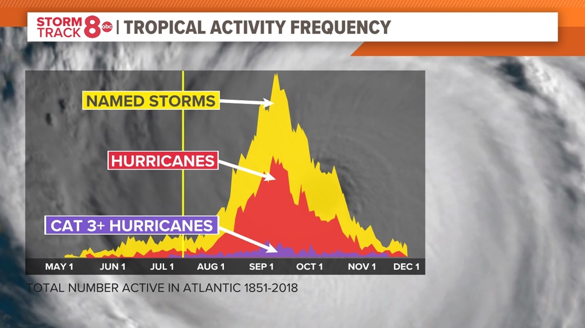
We haven't even touched the peak of hurricane season...yet
We're just getting started with hurricane season, which typically peaks in September. There remains a lot of uncertainty regarding whether or not the strength of the warmer water could possibly overcome the stronger wind shear in place across the region. Either way, folks should remain on guard as activity will likely pick up in some form or fashion in the next several weeks.

Have a question that you would like me to answer for an upcoming Ask Andrew segment? Submit it, here!